How do I find the largest emitter in my state?
Breadcrumbs
Changed
This page provides step-by-step instructions for finding the largest emitter in a particular state.
Step 1. Go to FLIGHT
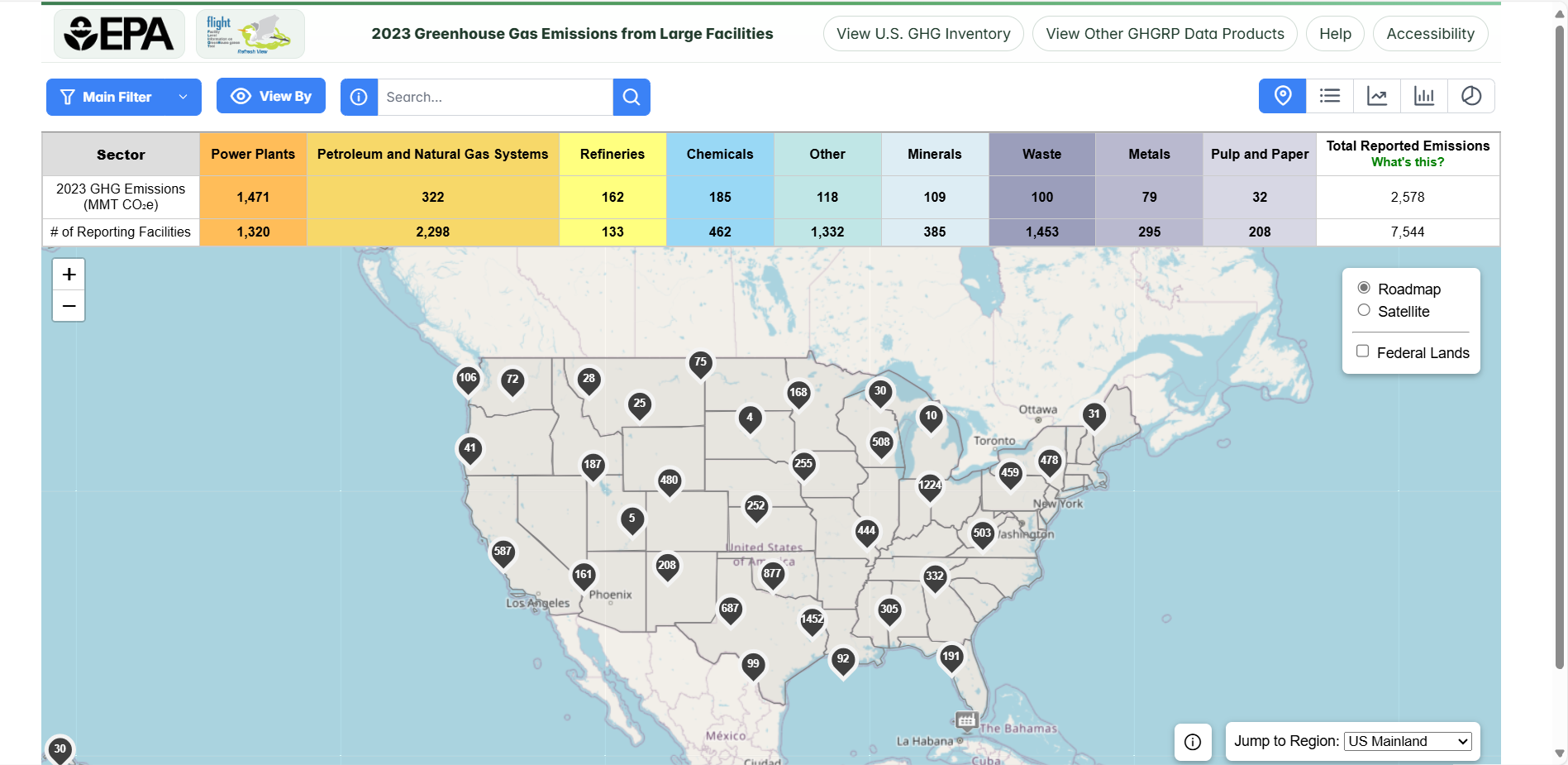
When you first enter the Facility Level Information on Greenhouse Gases Tool (FLIGHT), you will be presented with two search options:
- View all U.S. Facility Data by map
- View Facilities in your State
Step 2. Select the Main Filter Button
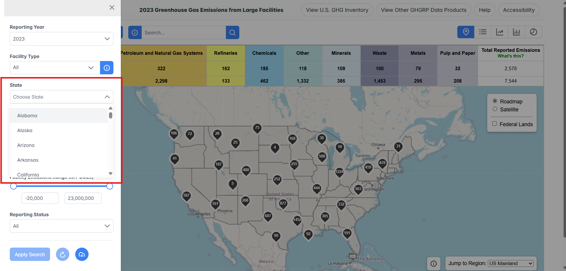
To open the main filters, select the Main Filter button located at the upper left-hand corner of the Map View.

Step 3. Select a state
Use the "Select State" search option to choose a state from the drop-down menu.
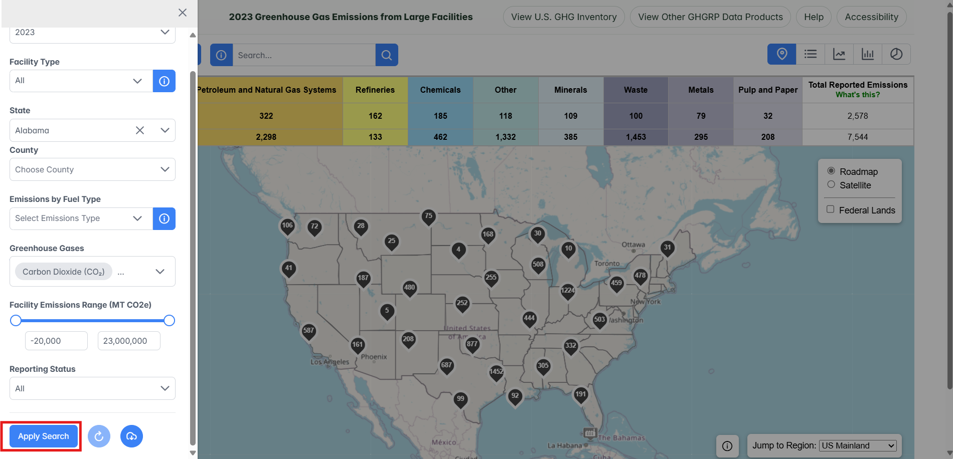
Step 4. Apply Search
Use the "Apply Search" button.
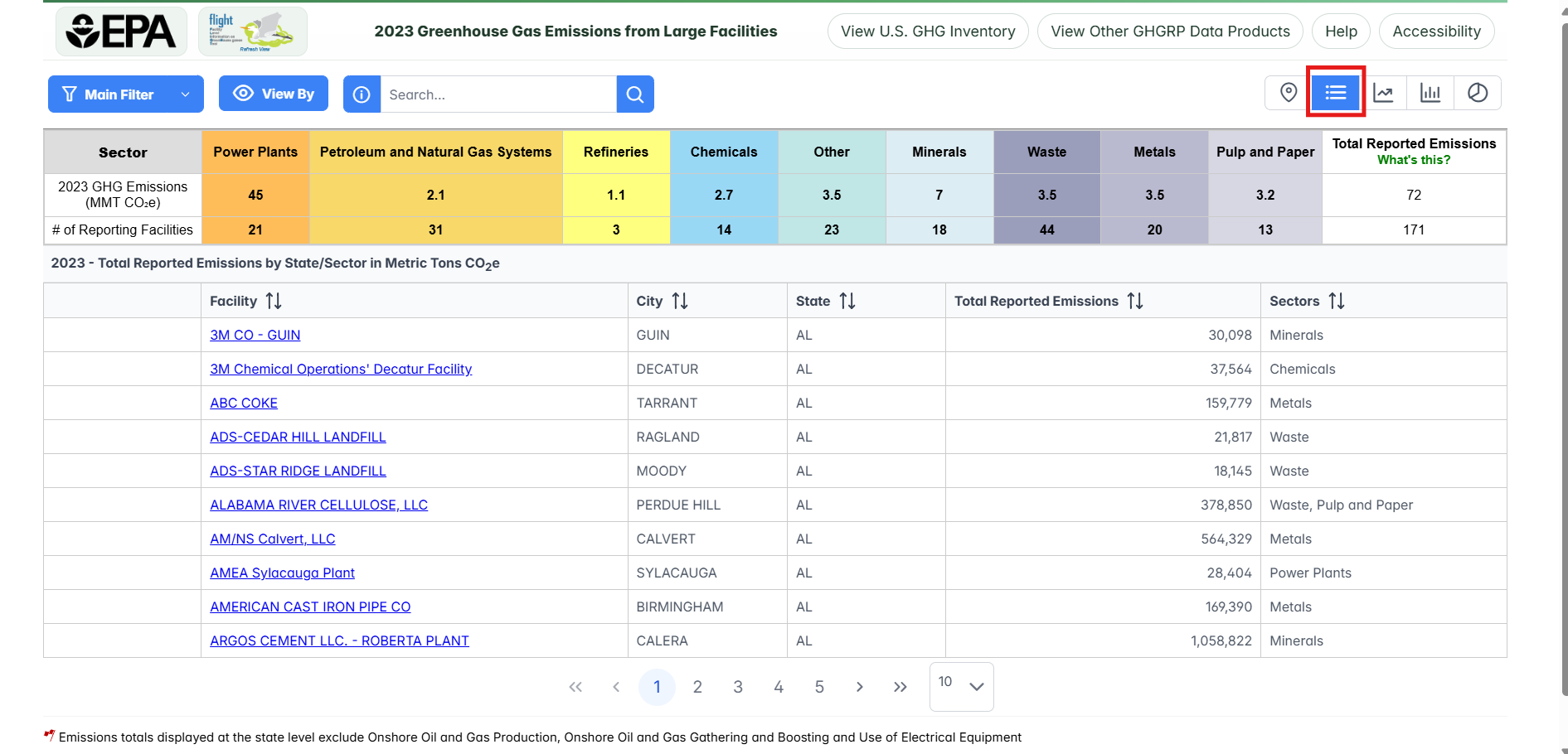
Step 5. Switch from Map View to List view (by facility)
Click the "List" button in the upper right-hand corner.
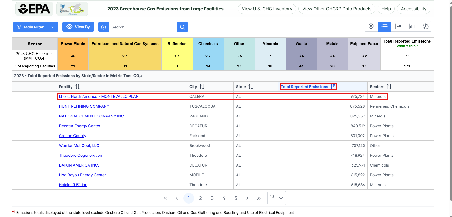
Step 6. Identify the largest emitter
Click the total reported emissions column header to sort the list. Clicking it once will sort from smallest to largest, a second time will sort from largest to smallest. The facility at the top of list is the largest emitter in the selected state.
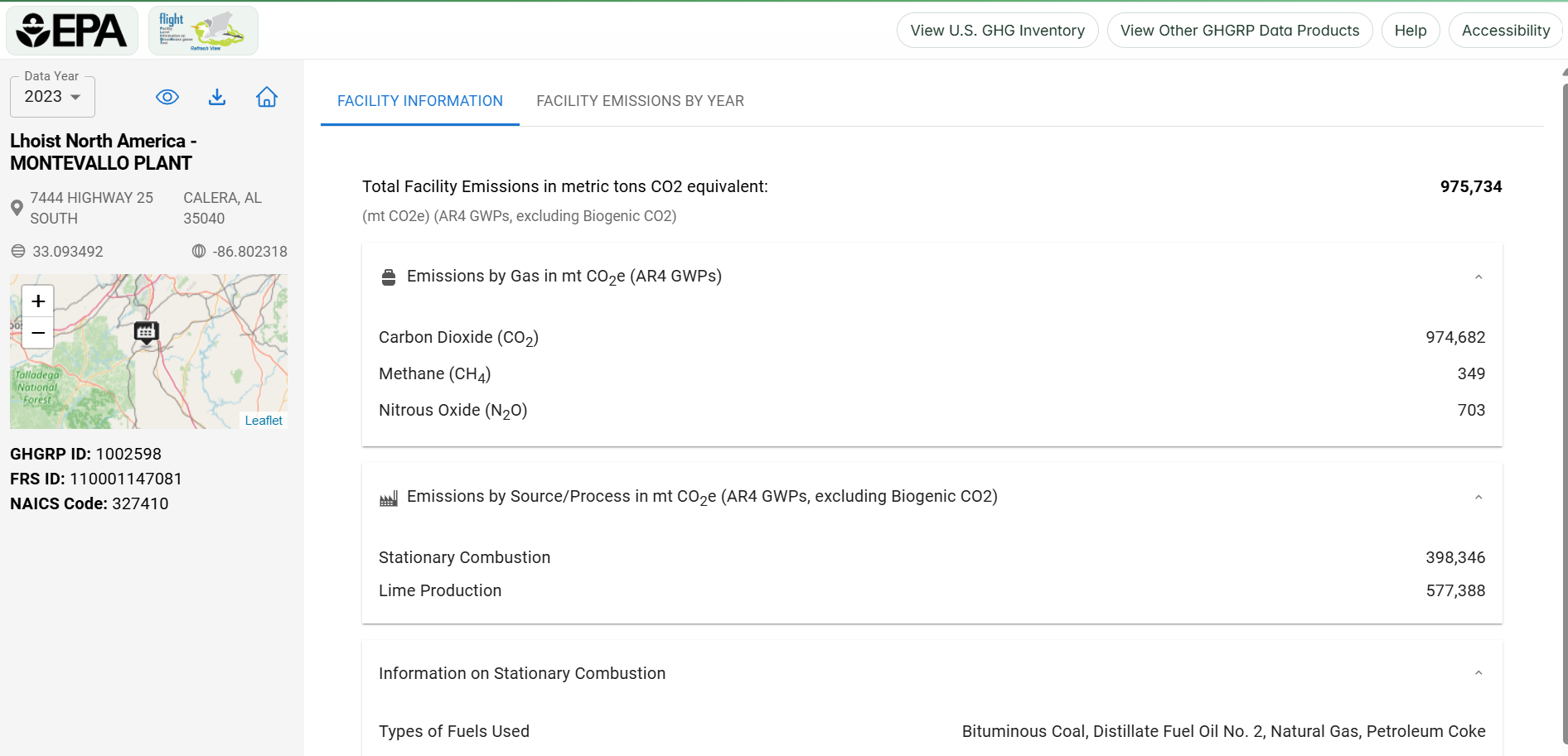
To view additional details for a facility, simply click the name of the facility in the left most column.
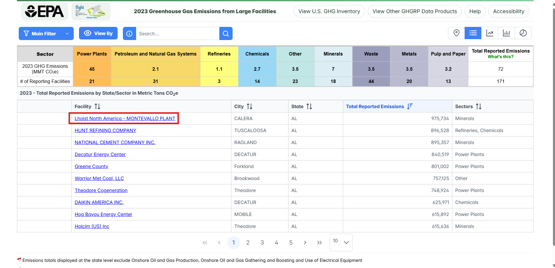
Then click on the facility in the listing below.